
The Wikimaps project was involved in a chain of international events. First in series was State of the Map Baltics organized in Tartu, Estonia. The series continued to Wikimania in Hong Kong ja finally the project was part of a code sprint organized to celebrate the 9th birthday of OpenStreetMap.
In Tartu
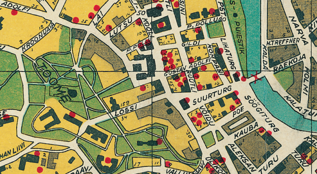
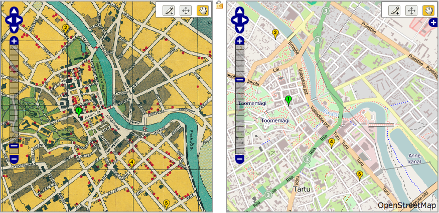
Together with the Baltic mappers we arranged a workshop on historical maps of Tartu. The Estonian National Archives, the National Library and Tartu University provided us with the old maps. They depict the city of Tartu over the years 1892–1986. All maps used in the workshop are now available in hi-res in Wikimedia Commons.
Pharus-Plan Dorpat, 1910
Tartu’s history is multifaceted: The fortress, that was known as Tarbatu in the first centuries AD, was renamed Yuryev when Yaroslav the Wise, the Grand Prince of Kiev renamed it after his Christian name Yuri. Conquerors and names kept changing since. In the end of the 13th century Tartu was a member of the Hanseatic League under the name Dorpat. For the Swedish rulers Tartu was known as Dorpat, as well as for the Polish ones. The Estonian name Tartu was adopted since Estonia detached from Russia in 1918. This was good material for our workshop.
OpenStreetMap actives from Estonia, Finland, Russia, Belarus and Poland were gathered in the main building of the Tartu University. OpenStreetMap Foundation representatives from western Europe attended also.
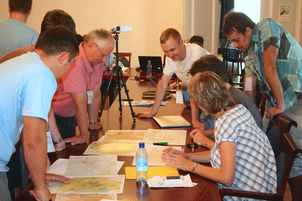
Wikimaps workshop in SotM Baltics CC BY-SA 3.0 Pekka Sarkola
We started the workshop early Sunday morning. I presented the maps and the challenges
- Who would use old maps?
- How could the historical maps be used?
- Comments on a specific section of the Wikimaps plan
We worked with a tight schedule in five groups. Attentive sounds of discussion filled the space. Two of the groups managed to get their thoughts on paper.
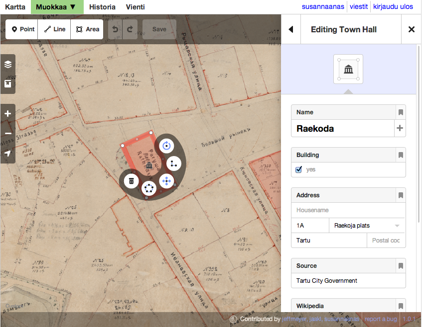
The first group discussed the properties that are to be collected from a map. As an example, when a mapper traces the Tartu Town Hall, there is no way of knowing the start_date, the construction year of the building – only that it existed at the given date. Or maybe the map is not truthful. In one of the maps from the Soviet era the geographic features had been falsified.
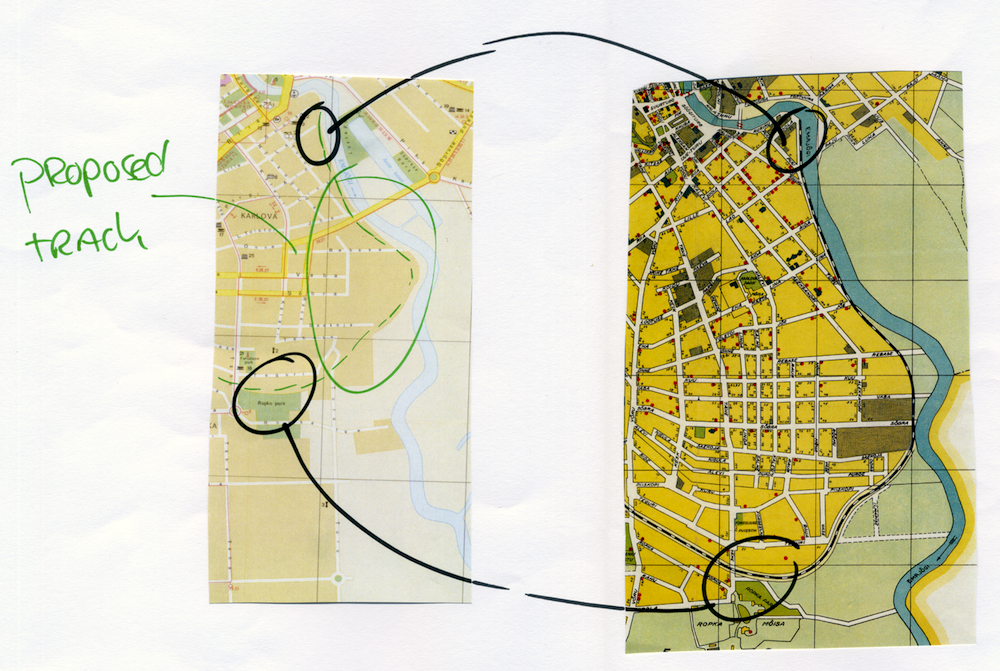
Jogging track from old railway line. What happens to travel times?
We discussed routing and calculating travel times along historical itineraries. Routes emerge and disappear: bridges are bombed, railway tracks removed and a cycling track is built in place, new highways are built.
The proposal for mapping Paris of the Musketeers triggered more ideas of placing literature on a map: Pubs of Joyce’s Ulysses, Sherlock Holmes’ London, Robin Hood in Nottingham and mapping the land of Kalevala, the national epic of Finland. Biographies of historical figures could be placed on a map in Wikipedia.
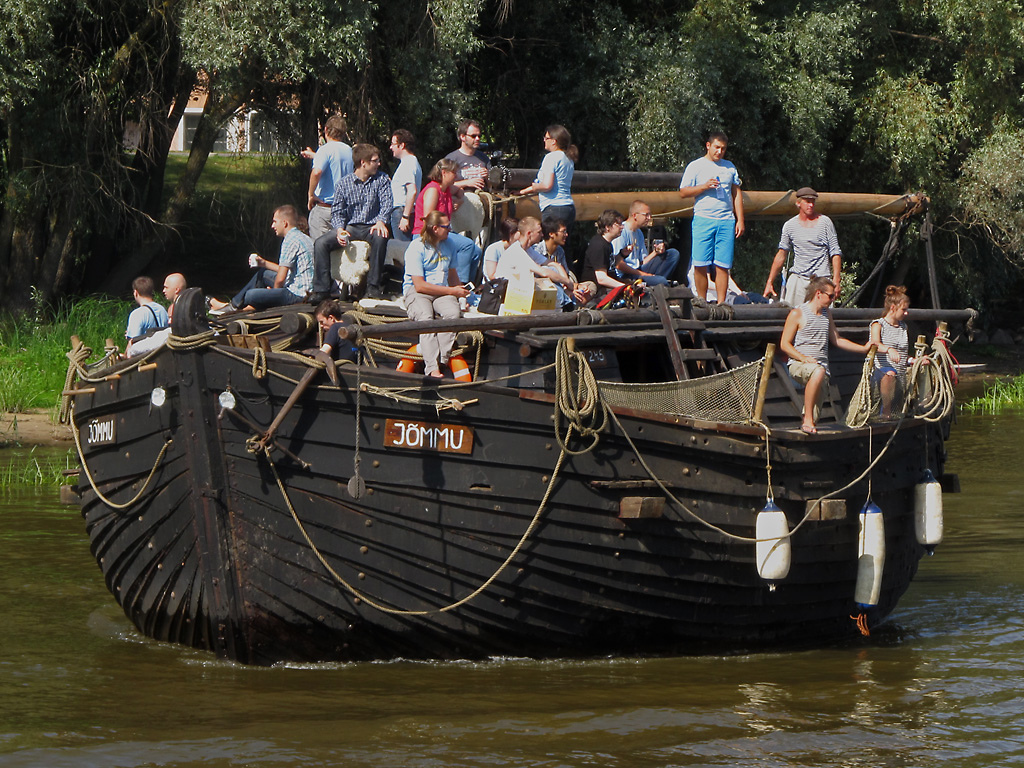
Wikipedian and mappers in the same boat. The boat trip in State of the Map Baltics. CC BY-SA 2.0 SK53 OSM
In Hong Kong
Later the same week hundreds of wikipedians gathered in Hong Kong for Wikimania from all over the world. During the event the participants in the multitude of Wikimedia projects can exchange experiences and tighten their collaboration. On the other hand it is an opportunity for the Wikimedia Foundation staff to discuss developing the environment together with the volunteers. For Wikimaps it was an chance to show what we have done and start establishing the project.
Round table discussion
The first thing done in Hong Kong was organizing a round table discussion about geodata in Wikimedia. Particiapants were people from Wikimedia projects that use geodata as well as people from the Wikimedia Foundation.
- Maarten Dammers presented the Geographicus map donation he has helped to upload in the Commons.
- Barbara Fischer presented a work in progress for a time-based animated map of Römisches Limes representing the erection and disappearance of Roman fortresses in Central Europe. The German Wikimedia organized an interesting event Wikidata trifft Archäologie 2013 this spring that gathered together the people working with definitions of place in the Ancient world.
- Hugo Lopez is starting a project where maps for Wikipedia articles could be created from GIS data dynamically.
- Daniel Kinzler explained the state of geodata in Wikidata.
- Wikimaps presented briefly.
- Tim Alder ja Daniel Schwen were present. They have been creating connections between Wikimedia and OpenStreetMap over the years. WikiMiniAtlas, OSM-Gadget, Geohack and WIWOSM have been made by them.
We discussed the needs of the projects and created a document.
Presentation
By the end of the week Susanna presented Wikimaps together with Maarten Dammers. Maarten is a volunteer of great projects in the Wikimedia Commons and he has originally proposed a project by the name Wikimaps.
Wikimaps Warper at work
We presented the Wikimaps Warper that has been customized for Wikimedia Commons by it’s original developer Tim Waters. It is now possible to georeference images in the Wikimedia Commons. The maps that have been georeferenced, can in turn be used in Open Historical Map for mapping historical features with OpenStreetMap tools.
OpenStreetMap Birthday Sprint
With all we had done and presented over the course of the week, we were part of the OpenStreetMap code sprint. 12 hour time zone difference made it impossible for us to do things together, simultaneously. The maps of Tartu had travelled from archives in Tartu via Hong Kong to an event in the US.
A Map of Tartu in the Open Historical Map environment, where you can use OpenStreetMap’s new iD tool.
Links
- Wikimaps
- Wikimaps Tartu–Hong Kong. Here you can try out georeferencing and mapping yourself.
- Wikimaps presentation, Hong Kong
- Tartu maps in Wikimedia Commons
- Jerry Clough writes about the Tartu workshop in his blog
- Pekka Sarkola writes about the workshop in his blog (in Finnish)
- Open Historical Map
- OpenStreetMap Birthday Sprint
who is design this maps?