
Artikkeli suomeksi
 We have been advocating a proposal for creating a web mapping service for historical maps within the Wikimedia project family.
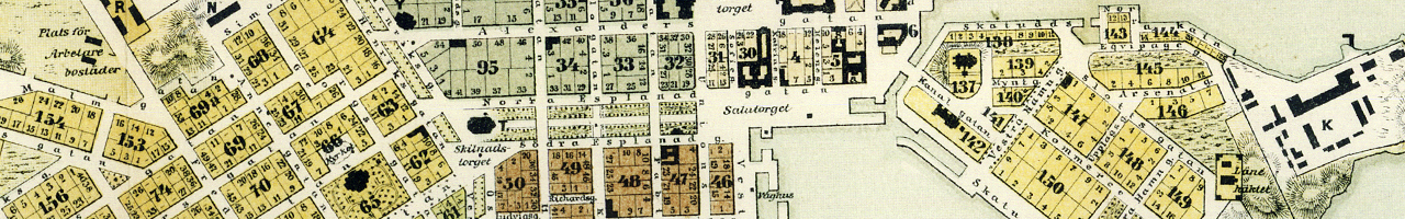
Imagine you could select a place on a map and rewind it to a moment in time. You could see maps that have been drawn at the time, but you could also see the place names, routes and buildings of the time, in your preferred language. You could take those maps and composite them with any geoinformation available on the net.

You could participate in creating the maps: take old maps, place them in their right place on Earth, draw and store the information. The information would be linked to articles in Wikipedia, through time, place and subject matter. Wikipedia articles would sample a map with just the right data layers, titles and style.
We are joining forces to see this happen. Most of the technological pieces needed for this are already present in the Wikimedia project family. We want to work together with OpenStreetMap Historic in finding out how to store information about the past places. We are creating communities for discussion. Are you a wikipedian, historian, designer, mapper, collector or GLAM looking after a map collection? Maybe you should join?
Wikimaps in Wikimedia Commons (English)
Wikimaps Facebook page (English + Finnish)
All maps and original aerial images Helsinki Region Infoshare http://www.hri.fi/lisenssit/hri-nimea/
Päivitysilmoitus: Wikimaps | Wikimedia Suomi
Päivitysilmoitus: Volunteers and staffers teach, learn, make at Amsterdam hackathon — Wikimedia blog